



How harmonised forest machine data supports dashboard control
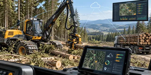
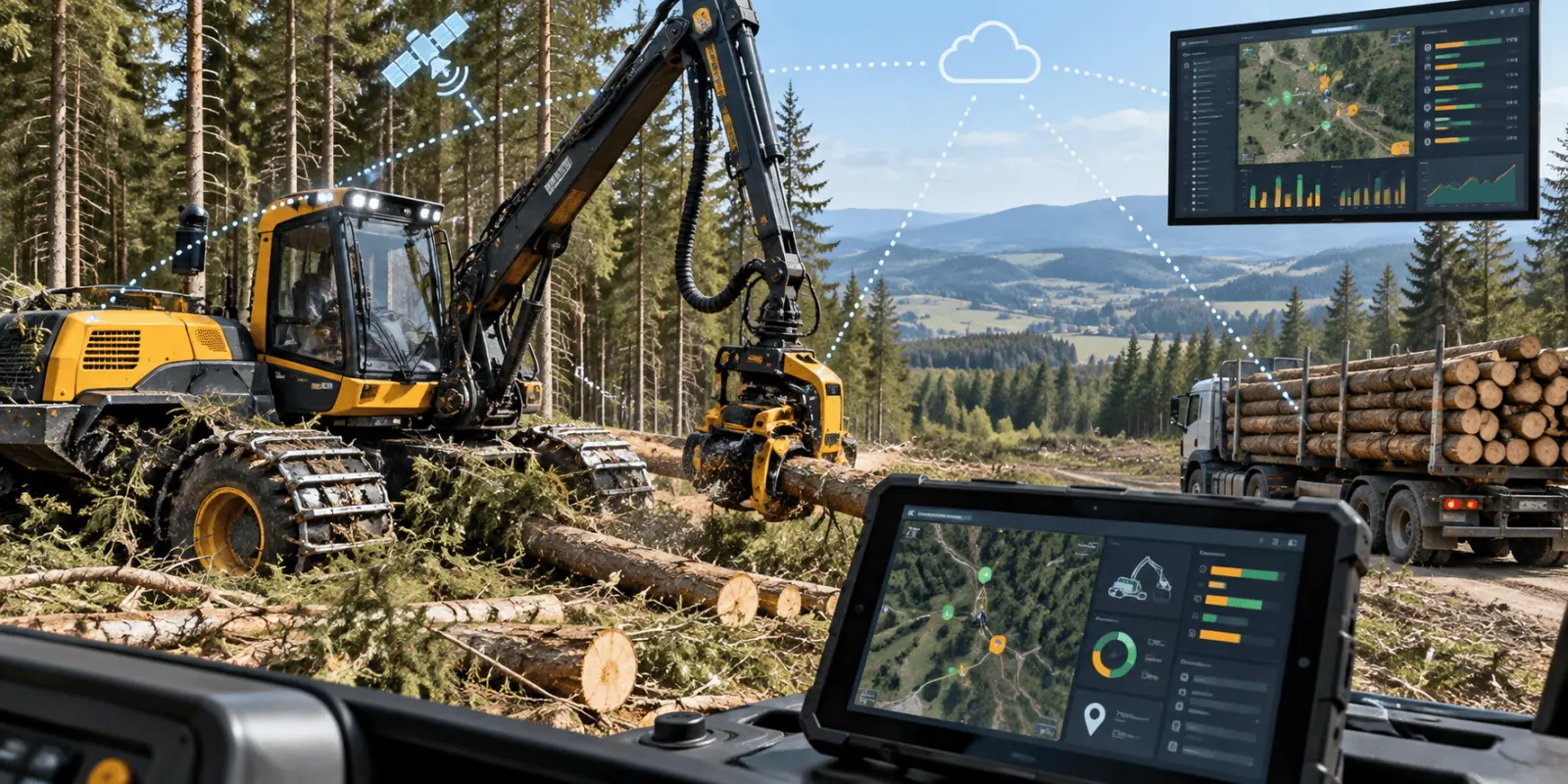
Harmonising measurements from harvesters, trucks and other forestry equipment can make operational data easier to combine, map and use in near-real-time process control. The 2015 Mittlboeck, Jank and Scholz paper proposed this as an interoperability problem: measurements from different systems needed common technical and semantic structures before a shared dashboard could reliably support decisions.
This explainer examines the paper's FOCUS project approach, the role of spatial and temporal context, the use of open sensor standards, and what later project reporting shows about implementation. The paper and project documentation describe architecture and prototypes rather than a controlled productivity trial, so they support conclusions about data integration and operational visibility, not a quantified claim that the system reduced costs.
INFOBOX
Source paper | Mittlboeck, Jank & Scholz, FORMEC 2015, pp. 55-61 |
Project | FOCUS - Advances in Forestry Control and Automation Systems in Europe |
Core problem | Proprietary sensor systems and incompatible data models across the forest supply chain |
Data context | Machine and vehicle measurements linked with location and time |
Interoperability approach | OGC Sensor Observation Service, Observations & Measurements and related sensor-web concepts |
Operational layer | Near-real-time collection feeding shared monitoring, planning and control services |
Stakeholders | Forest enterprises, harvesting firms, haulage companies and processing industry |
Archive record | 20163242080 |
Why forest-machine data needed harmonisation
Modern harvesting equipment can generate large streams of operational information, but the value of those measurements depends on whether they can be exchanged and interpreted outside the machine that produced them. The 2015 paper framed the problem at supply-chain level. Forestry operations involve different organisations, machines and software systems, while sensors and proprietary data models had proliferated independently. A harvester, a wood truck and a planning office could therefore hold useful information about the same operation without sharing a common structure for describing what was measured, where it was measured and when it happened.
The authors argued that technical interoperability alone was not enough. A receiving system also had to understand the meaning of a measurement. For example, a number representing engine speed, vehicle position or production volume is useful only when its unit, sensor, time stamp, location and operational context are interpretable. Their proposed solution combined technical standards for moving data with semantic conventions for describing observations.
The FOCUS project treated harvesting as a connected process
The conference paper was produced within the EU-funded multinational FOCUS project. Its broader aim was to improve planning and control across forest-based supply chains by connecting sensors, communication services, analytics and operational decision tools. Rather than viewing harvesting as an isolated machine task, FOCUS treated the chain from standing timber through harvesting, forwarding, transport and processing as a sequence of linked activities.
That perspective changes what counts as useful data. A harvesting company may care about production and machine status; a haulier needs position and load-related information; a forest enterprise needs progress against plan; and an industrial processor needs visibility of incoming material. A shared information architecture can only support all of these actors if data from heterogeneous sources can be translated into a common operational picture.
The information had to be spatial and temporal
The authors emphasised that forest-supply-chain actors move through space and time. Measurements therefore needed more than a value: they needed coordinates or spatial references and a time dimension. In the project's truck example, vehicle sensor information was combined with location and time obtained from a mobile device. This allowed status information to be associated with a place on the network and a moment in the operation rather than remaining an isolated machine reading.
What the proposed data flow connected
Element | Role in the system | Example from project documentation |
Machine or vehicle sensors | Generate operational measurements | Engine status, speed, CAN-bus/OBD-derived values |
GNSS / mobile sensors | Add position and time context | Truck location and movement |
Harmonised data model | Represent measurements consistently | Observation structures based on OGC/ISO concepts |
Sensor service | Expose observations through a common interface | OGC Sensor Observation Service 2.0 |
FOCUS core | Integrate data with planning and control components | Shared platform architecture |
Dashboard / mobile layer | Present status to users | Location-independent monitoring and operational views |
Open sensor standards were used as the interoperability bridge
The presentation accompanying the paper identifies the Open Geospatial Consortium Sensor Web Enablement family as the main standardisation route. It specifically discusses the Sensor Observation Service (SOS), SensorML and Observations and Measurements (O&M). SOS defines a service interface for querying observations and sensor metadata, while O&M provides a conceptual model for describing observation acts and results. ISO 19156:2011 formalised the same observation-and-measurement model for information exchange across scientific and technical communities.
This matters because a dashboard should not have to implement a custom connector for every machine manufacturer or sensor vendor. A standards-based service can expose observations through defined operations and a consistent representation. The project presentation highlighted operations such as retrieving service capabilities, requesting observations and describing sensors. The point was not that one standard solved every forestry problem, but that a shared observation model could give diverse systems a common exchange layer.
Near-real-time control depends on data that different machines and organisations can interpret in the same way.
Near-real-time collection linked field activity to dashboards
The Austrian case presented at FORMEC moved from architecture to a concrete collection workflow. For wood trucks, the project identified position, engine status and additional contextual information as useful monitoring inputs. The presentation describes combining vehicle measurements with mobile-device GNSS, transmitting the combined observations over IP and using local application caching when connectivity was temporarily unavailable.
That design is important in forestry because field connectivity can be intermittent. Near-real-time does not necessarily mean every measurement reaches the server instantly. A practical system may collect and time-stamp observations locally, store them during an outage and forward them later without losing the operational sequence. This allows dashboards to remain useful while acknowledging the network conditions of remote forest operations.
From monitoring to process control
FOCUS was designed to do more than display telemetry. The project architecture linked sensor data with planning, monitoring and model-based control. In the accompanying presentation, data feed a control cycle in which deviations can be recognised, alarms can be raised and instructions or revised set-points can be proposed. CORDIS later reported dashboards and business analytics for remote supervision, together with tools for dynamic replanning when operations were delayed or changed.
This is the step that turns interoperable measurements into operational value. The dashboard is not valuable simply because it contains more data; it is valuable when standardised data arrive with enough context to support comparison with plans, identification of deviations and coordination among firms.
How forestry-specific standards fit beside general sensor standards
Forestry already had an important machine-data standard: StanForD, maintained by Skogforsk. StanForD and its later XML-based StanForD 2010 were designed for communication with forest-machine computer systems and for control, reporting and monitoring of logging production. That makes StanForD highly relevant at the machine and wood-production layer.
The FOCUS approach addressed a broader integration problem. Its architecture had to combine information not only from harvesters but also from trucks, mobile devices and other sensors used across multiple organisations. General geospatial sensor standards therefore complemented forestry-specific structures by giving heterogeneous observations a common spatial-temporal interface. The two approaches are not competitors: one is domain-specific, while the other provides a wider interoperability framework.
For a practical interoperability stack, the roles can be separated as follows:
- forestry machine standards structure domain-specific production and machine information;
- sensor standards describe and expose observations from different devices;
- spatial and temporal references place those observations in operational context;
- dashboards and control tools turn harmonised observations into decisions.
What the 2015 work demonstrated - and what it did not
The conference paper and presentation demonstrate a coherent technical concept and working prototype components. They identify the interoperability problem, specify standards, show a mobile collection workflow and place the data inside the FOCUS planning-and-control architecture. Later EU project reporting states that FOCUS prototypes were implemented and tested in case studies in Finland, Belgium, Switzerland, Austria and Portugal, covering major forest-based value chains and multiple stages from harvesting to downstream processing.
However, the paper abstract and presentation do not provide a controlled economic comparison showing a specific percentage reduction in harvesting cost, fuel consumption, delay or idle time caused by the harmonisation approach. The original motivation was cost optimisation and improved situational awareness, but those are objectives and expected operational benefits rather than quantified outcomes established by the conference paper.
The most durable result is the architecture
That distinction does not make the work less useful. The architecture anticipated a central challenge of digital forestry: how to turn many streams of automatically collected machine data into information that can move across organisational boundaries. Later research on harvester big data has reinforced the value of automatically recorded machine information for productivity analysis, while modern StanForD versions continue to support standardised reporting from forestry equipment.
The lasting lesson is that data volume alone does not create operational intelligence. Measurements need consistent definitions, metadata, time and location, a transport interface and applications that understand the resulting structure. When those layers align, a dashboard can represent a shared operational state instead of a collection of incompatible sensor feeds.
Why this matters for precision forestry today
Precision forestry increasingly depends on connected machines, positioning, automated measurement and digital planning. The 2015 FOCUS work is useful because it shows the integration problem at the boundary between those technologies. A modern harvester can record detailed production information, but cross-company coordination still requires rules for how data are described, transmitted and interpreted.
The architecture also highlights why interoperability has both a technical and an organisational dimension. A sensor value is only useful outside the originating machine when receiving systems know what was measured, when and where it was measured, which units were used and how the observation relates to the forestry process. Common interfaces solve part of that problem, but shared semantics and metadata are equally important if several companies or software platforms are expected to use the same information.
This becomes more important as the number of data sources grows. Harvesters, forwarders, timber trucks and mobile devices can all contribute observations, but a dashboard cannot support process control if those streams use incompatible definitions or lose their spatial and temporal context. The FOCUS work therefore anticipated a continuing challenge in digital forestry: creating a chain in which measurements remain interpretable from collection through transmission, storage, visualisation and operational decision-making. In practice, that means the quality of integration matters as much as the volume of telemetry collected. A smaller set of well-described observations can be more useful for coordination than a larger stream of measurements that cannot be compared reliably across machines, organisations or software systems.
For current systems, the exact technologies continue to evolve. StanForD has moved through later versions, OGC observation standards have been updated, and cloud and mobile architectures are more capable than they were in 2015. The underlying requirement is unchanged: a measurement must retain its meaning as it moves from the machine that generated it to the service, dashboard or decision tool that uses it.
Frequently asked questions
What does harmonising forest-machine measurements mean?
It means representing measurements from different machines and sensors in compatible structures so another system can interpret them consistently. In the FOCUS work, harmonisation included technical exchange standards plus semantic information about what was measured, where it was measured and when the observation occurred.
Why is location important in a forestry dashboard?
Harvesting, forwarding and timber transport are spatial activities. A machine-status value becomes more useful when it is tied to position and time because managers can relate it to a stand, road, landing or transport route. The FOCUS case combined vehicle measurements with GNSS-based location and time context.
Did the 2015 paper prove that dashboards reduced harvesting costs?
No. Cost optimisation was a motivation for the FOCUS project, but the conference paper and presentation do not report a controlled cost-effect estimate. They support claims about the interoperability architecture, sensor-data collection, standards and monitoring concept rather than a specific percentage saving attributable to the dashboard.
How does StanForD differ from OGC Sensor Observation Service?
StanForD is a forestry-specific standard for communication and data from forest-machine computer systems, including production reporting and monitoring. OGC Sensor Observation Service is a general geospatial sensor interface for querying observations and metadata. FOCUS used broader sensor standards to integrate heterogeneous sources across the supply chain.
What is the main limitation of near-real-time forestry monitoring?
Data can only support rapid decisions if connectivity, timestamps, metadata and semantics are reliable. Remote forestry sites may have intermittent communications, so the FOCUS prototype used local caching when needed. Near-real-time monitoring therefore depends on both data standards and practical mechanisms for collecting and forwarding observations.
Sources
- Mittlboeck M, Jank R, Scholz J. Harmonizing measurements from wood harvesting machines to support near real time spatio-temporally enabled dashboards for process control. In: Forest engineering: making a positive contribution. Proceedings of the 48th Symposium on Forest Mechanization. 2015:55–61.
- Mittlboeck M, Jank R, Scholz J. Harmonizing measurements from wood harvesting machines to support near real time spatio-temporally enabled dashboards for process control. FORMEC 2015 presentation. Linz, Austria; 2015.
- European Commission CORDIS. Advances in FOrestry Control and aUtomation Systems in Europe (FOCUS). FP7 project 604286. Reporting and results. Accessed 9 September 2026.
- Skogforsk. StanForD – Standard for Forest Machine Data and Communication. Accessed 9 September 2026.
- Skogforsk. StanForD 2010: objectives, scope and implementation history. Accessed 9 September 2026.
- Open Geospatial Consortium. OGC Sensor Observation Service Interface Standard 2.0. OGC 12-006. Accessed 9 September 2026.
- International Organization for Standardization. ISO 19156:2023 Geographic information — Observations, measurements and samples. Accessed 9 September 2026.
- Open Geospatial Consortium. OGC Abstract Specification Topic 20: Observations, Measurements and Samples. Version 3.0. OGC 20-082r4. Accessed 9 September 2026.
- Olivera A, Visser R, Acuna M, Morgenroth J. A Big Data approach to forestry harvesting productivity. Computers and Electronics in Agriculture. 2019;161:29–52. doi:10.1016/j.compag.2019.02.029.

Tobias Mardle — author
Tobias Mardle is an author with a background in agricultural engineering. A graduate in Agricultural Engineering, his earlier work focused on explaining farm machinery, guidance systems and the use of field data to growers and agricultural advisers. At CAB Dir...
Related
Calendula, crotalaria and oats for root-knot nematodes in naranjilla

Why breadfruit mealybug control failed to last on Pacific atolls
Organic vs Conventional Farming: Economics and Ecology
Hevea brasiliensis breeding: from crosses to field trials